In my last post, I shared some photographs of the historic jug bridge that carried the National Road over the Monocacy River, near Frederick, Maryland, for more than 130 years. In this post, I'll share some photographs of the site as it is today. In my next post, I'll have some photographs of the beautiful concrete arch bridge which replaced the stone one, and which has, in turn, been replaced.
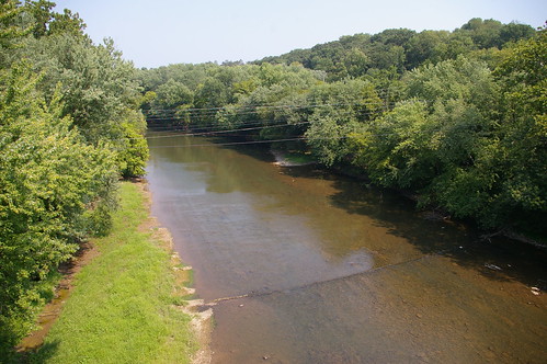
Above, the location of the jug bridge in the Monocacy River, as seen from the concrete arch bridge - the stone arch bridge crossed the river a bit above the cable line running through the water.
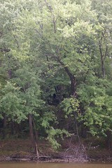
No remains of the bridge are visible on the eastern bank of the river, though more investigation is warranted.
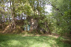

The western abutment and approach have survived.
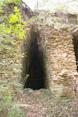
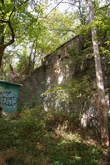
Interior structure of the bridge.
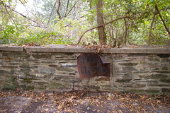
On top of the western abutment, one encounters this wall and sign, preventing further travel - at the present, this is a somewhat moot point, as the road becomes private before it gets here.
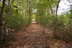
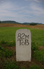
This is the view from the "Road Closed" sign, looking west, toward Frederick.
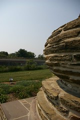
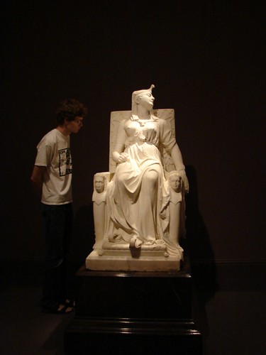
The jug from the bridge has been preserved in a park in Frederick.
5 comments:
I would like to go see this! I think I'll have to do some hiking. I took a photo of the jug at the memorial.
http://www.flickr.com/photos/29968526@N08/4980947311/
It's actually now private property along Dr. Baxter Rd. I lived on that side and hiked it down. Later upon encountering my neighbor and telling of my hike did I see his displeasure. I understand his point as we've now had a lot of trash and unsavory things happening down there. Don't be surprised if you're at the least encountered or at most visited by the police.
On the western side (same day), we encountered someone in one of the houses come out with a shotgun. We were walking with our dog on the clear road. By boat is probably your best bet for the sights as the eastern side is scaling shale and not at all a hike.
I'm looking for old pictures of what is now Dr. Baxter road as I am sure it did not turn at it's end where it meets Linganore Rd.
Nice to see the jug was saved.
This waas great to read
Post a Comment