Monday, January 14, 2008
Driving Route Maps Updated!
View Larger Map
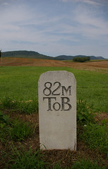
Over the course of the past week, I've gone through all of the small (5 mile segment) driving maps of the National Road in Maryland and completely updated them. Driving routes are correct for the entirety of the state. Virtually all old alignments have been noted, to the extent that the aerial photographs allow me to see. The driving route is shown in blue, the eastbound driving route, if different, in light blue, drivable old alignments, in green, and undrivable old alignments, in red. Points of interest will be added in coming weeks.
Subscribe to:
Post Comments (Atom)

2 comments:
My sons and I are talking about a trip to DC over Spring Break in 2009, with a trip home along the National Road (because that would make Dad happy). You realize, of course, that your Maryland maps make me want to make the DC portion of the trip shorter, so the National Road portion of the trip can be longer!
Hey, I take no responsibility....
Enjoy the drive. I hope to add more points of interest that aren't immediately on the path of the road, especially between Frederick and Hagerstown, which has what is quite possibly the most beautiful built landscape that I've ever seen.
Post a Comment