The stone bridge at Puzzley (sometimes Puzzly) Run, west of Grantsville, Maryland, came up briefly once before, but I never wrote much, primarily because there was nothing to write - I couldn't reconcile the path of the road today, the bridge, and the previous alignment.
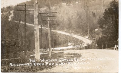
This turn of the century postcard shows the bridge, between the two curves of the road, as seen from a bit farther west.
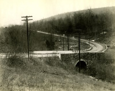
This is the south side of the bridge, the same one shown in the color photograph above. It was probably taken in the 1920s, by the Maryland State Roads Commission.
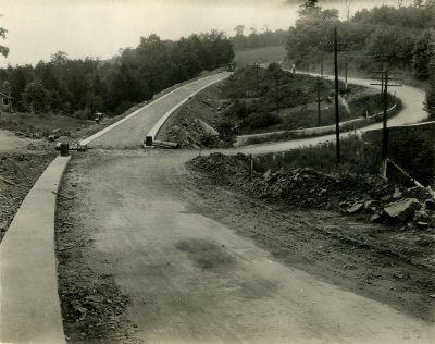
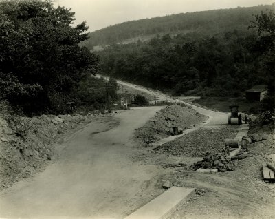
This view, looing west, shows the stone bridge on the right and the new alignment of the road on the left. 19th century bridge builders tended to take the straightest path possible across a stream, as it was cheaper and easier to build bridges this way. Automobiles, travelling at higher speeds, could not easily navigate these sharp curves, so in 1932, the road was straightened, eliminating this bridge. Photograph by the Maryland State Roads Commission, September, 1932.
This view, looking east toward Grantsville, is from almost the same location as the black and white postcard above. Photograph by the Maryland State Roads Commission, September, 1932.
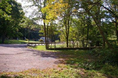
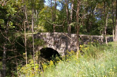
This photograph, taken last summer, shows the current route of Route 40. The structure that appears to be a stone wall, in the center of the picture, is the south side of the bridge.

The bridge has deteriorated rather considerably. Little remains of the north side. The west end of the south wall is lacking. Still, given that the bridge is probably 180 years old and that it hasn't had any maintenance for at least the past 90 years, it looks quite good. It appeast to be structurally sound, and may still be in use, as a driveway to a private residence.
The three photographs by the State Roads Commission are used courtesy of the Enoch Pratt Free Library, Central Library / State Library Resource Center, Baltimore, Maryland.
1 comment:
National Road was relocated here, west of Grantsville, Maryland, to remove a sharp curve in the road where it crossed over Puzzley Run. Early 19th century engineers designed roads so that bridges could be built over them at right angles, which was the cheapest and most efficient manner. This led to the existence of sharp curves just before and after bridges, which, while acceptable for horses, was not so acceptable for automobiles. The old bridge, which is almost invisible from the road today, has deteriorated considerably since this photograph was taken.
Photograph by the Maryland State Roads Commission, September, 1932
Post a Comment