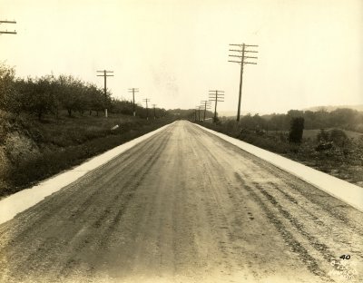
This 1920s or 1930s photograph, by the Maryland State Roads Commission, shows the area east of Hancock looked like before I-70 was cut through. The spot is on the National Road, about two miles east of Hancock, as seen from the west, looking east. Fruit orchards, like those on the left were plentiful.
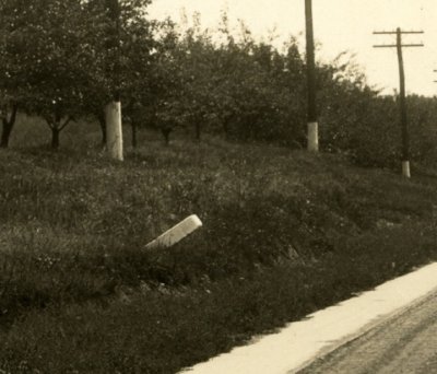
The white object on the left side of the road, enlarged here, appears to be milestone 95 M to B. This milestone, along with 94 and 93, sit in the median of I-70, close to their original positions. Due to a relatively narrow shoulder and large quantity of traffic, I have not been able to obtain a photograph of milestone 95 to acertain that it is, in fact, what is pictured here.
Photograph used courtesy of the Enoch Pratt Free Library, Central Library / State Library Resource Center, Baltimore, Maryland.
No comments:
Post a Comment